Too many places on your UPSC map list? Start with four rivers.
Updated
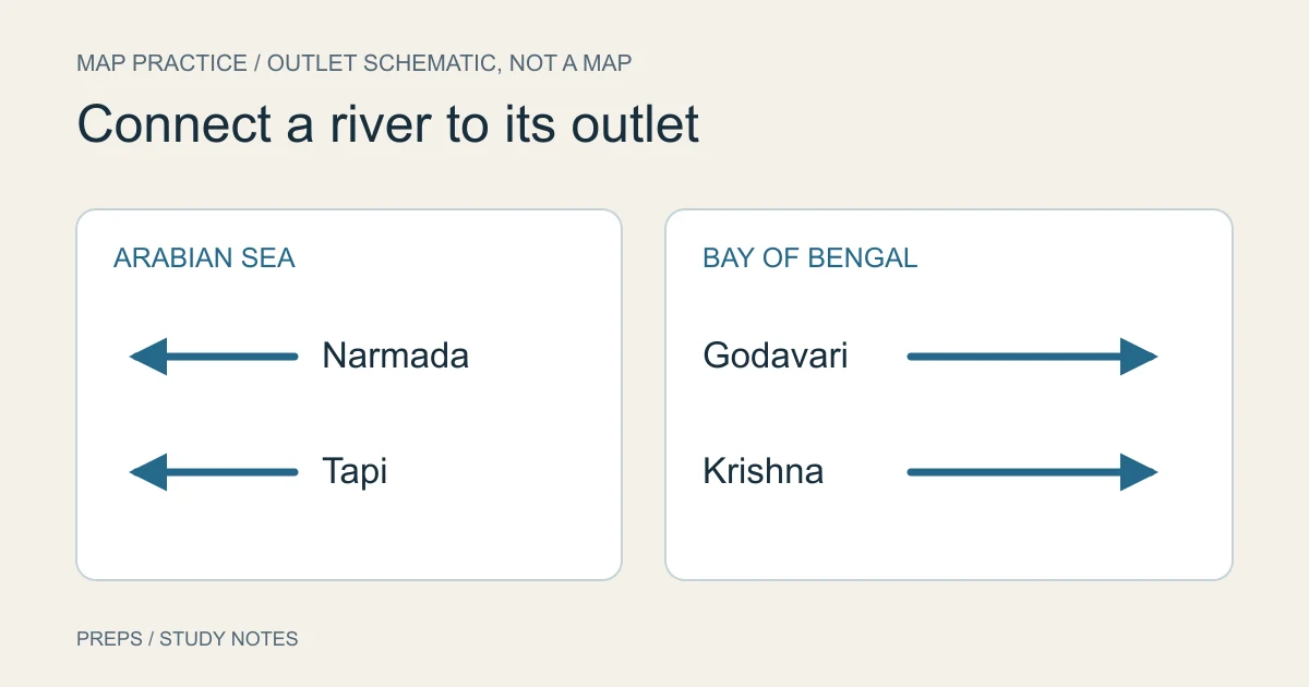
Find the Narmada on a labelled map. Now put the map away and place it on a rough outline, showing which coast it reaches.
The second task can be harder even when the first felt effortless. If that's where you get stuck, I'd change the exercise before adding another hundred places to your list.
Map practice for UPSC needs some time with the labels hidden. It also needs a reason to connect one location to another. You can start with a small group of rivers and build an exercise you can check.
Set up one reference and one blank sheet
Open figure 3.2, “Major Rivers of India”, on printed page 18 of NCERT's Class XI India: Physical Environment, Drainage System, 2026–27 reprint. Keep a blank sheet beside it.
For this original exercise, use four rivers: Narmada, Tapi, Godavari and Krishna. Find each on the map and trace it to its outlet. Look at the north arrow, the coasts and the surrounding land before studying an isolated river line.
The chapter's map and accompanying text show Narmada and Tapi draining towards the Arabian Sea, while Godavari and Krishna reach the Bay of Bengal. Within these pairs, notice the relative north–south positions on the map.
This small set is a teaching choice, not a prediction about the next paper or a list of the only rivers you need to study.
Make the map answer a few connected questions
With the reference open, work through these tasks:
- Locate both seas and say which is on India's western side and which is on its eastern side.
- Trace the Narmada and Tapi separately to the west coast. Compare their positions so that you don't remember them as one interchangeable line.
- Trace the Godavari and Krishna to the east coast. Again, distinguish the two courses and their relative positions.
- Follow each river across the map rather than jumping from its printed name straight to the sea.
The purpose is to connect a name, a course and an outlet. A coloured dot beside “Narmada” tells you where the label was printed. It may tell you very little about the river.
Use the text for a source or tributary detail when you need it. Don't infer a precise origin from the nearest large city label. A small-scale map simplifies the world; the amount of detail it can support is limited.
Hide the reference and make something you can check
Put the map away. Sketch a rough peninsular outline with the two coasts and mark north. Place the four rivers, name their outlets, and show their relative positions.
You aren't reproducing the textbook's cartography. This is a private recall sketch, and it can be untidy. Its job is to reveal whether you can reconstruct the relationships.
Open the reference and compare. Mark the particular error:
- Wrong coast: revisit the river's course and outlet.
- Right coast, confused pair: compare the two river lines and their north–south relationship.
- Name remembered, course missing: trace the full line again, including where your sketch stopped.
- Sketch broadly right, detail uncertain: find an appropriately detailed map or text before adding that detail as a fact.
Keep the corrected sketch with a short question for the next attempt. “Place Tapi relative to Narmada” gives you a task. “Revise rivers” leaves you to invent the exercise again tomorrow.
Change the question once the first sketch becomes familiar
Try this original practice prompt:
A river reaches the Arabian Sea. Is that fact alone enough to identify it as the Narmada?
It isn't: even this small exercise includes another river with that outlet. You need a further distinguishing clue. Use the map to explain what you would compare rather than treating “west-flowing” as a unique identity.
Then ask a spatial question: can you place the two east-draining rivers in this exercise without swapping their relative positions? Check the reference after attempting it.
These aren't UPSC questions or a shortcut for guessing an answer. They test whether the relationships survive a change in wording. For examining actual paper demands, use the separate PYQ-analysis guide.
Expand by one useful relationship
Once you can reconstruct this group, add something that connects to it: a tributary, a nearby landform or another river you are studying. Verify the addition in an appropriate reference.
For a place in the news, begin with the location and a nearby feature that helps you orient it. Keep the news claim separate. A map can show where a port lies; it doesn't by itself establish the port's current operating status, ownership or a new agreement.
I'd also distinguish current political boundaries from the physical relationships you're studying. Check the map's edition and legend before using it for a claim that may have changed. Don't copy an old administrative label into today's notes merely because the river beside it is familiar.
Keep the task small enough to revisit
Choose a set you can actually place and check within the session available. A smaller completed exercise leaves a clearer record than an atlas tour you can't reconstruct.
There will still be names to learn. The decision is what you ask yourself to do with them. Next time, begin with your earlier blank-sheet task before opening the reference. Add the next group after checking whether the first one still holds together.